Southeast Asia

This website will give you an introduction to the geography, history and people of Southeast Asia.
A short introduction to Southeast Asia
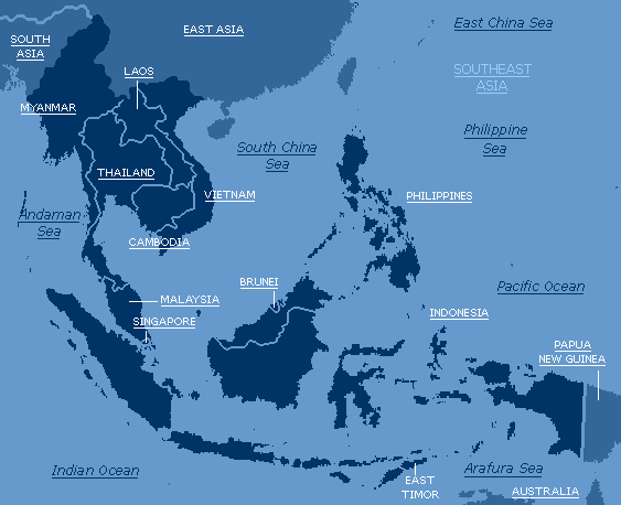
Southeast Asia is a region made up of ten countries, which are:
Southeast Asia is situated north of Australia, south of China, west of the Pacific Ocean and east of the Indian Ocean and the Indian Subcontinent (India, Pakistan and Bangladesh). More precise coordinates are 28°North to 11°South and 130°East to 90°East.
Southeast Asia has a total population of 515,378,318 people (2000 estimates) and a land area of about 4,523,000 km² - about 19 times larger than the UK. The countries in Southeast Asia range from the communist countries (Vietnam and Laos), a military-controlled state (Myanmar), an oil-rich monarchy (Brunei), a constitutional monarchy (Thailand) and five democratic states (Malaysia, Indonesia, Singapore, Cambodia and the Philippines). Nine out of the ten countries in Southeast Asia were once colonies (Singapore, Malaysia, Brunei and Myanmar ruled by the British, Cambodia, Vietnam and Laos by the French, the Philippines first by the Spanish followed by the Americans and Indonesia by the Dutch), the only exception being Thailand. In Thailand, King Bhumibol has no real power in the government. However, he has enormous influence and has forced corrupt governments to resign.
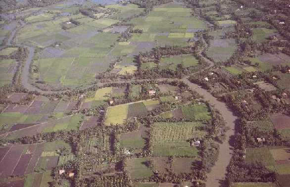
Southeast Asia stretches more than 6000 km from the northern hills of Myanmar to forests of Irian Jaya (West Papua), 250 km from Australia. Southeast Asia is generally divided into two parts - the "mainland" Southeast Asia, which consists of Myanmar, Thailand, Cambodia, Vietnam and Laos, and "insular" Southeast Asia, made up of Malaysia, Singapore, Indonesia, the Philippines and Brunei. Indonesia alone is made up of 13,677 islands and the Philippines of 7,100 islands (how are they counted?). Major rivers in Southeast Asia are the Ayeyarwady (Irrawaddy) in Myanmar, the Chao Phraya in Thailand and the Mekong and Huang He in Vietnam. They have been transformed into large areas of rice cultivation.

Southeast Asia facts:
If you think you know all about Southeast Asia, go to our quiz page
Sources
"Thailand", Microsoft® Encarta® Online Encyclopedia 2001 http://encarta.msn.com © 1997-2001 Microsoft Corporation. All rights reserved.
"Southeast Asia", Microsoft® Encarta® Online Encyclopedia 2001 http://encarta.msn.com © 1997-2001 Microsoft Corporation. All rights reserved.
Maps of Southeast Asia, Microsoft® Encarta® Online Encyclopedia 2001 http://encarta.msn.com © 1997-2001 Microsoft Corporation. All rights reserved.
Picture of the Mekong River, World Fact Files - South-East Asia © 1994 Macdonald Young Books
Pictures of landmarks in some Southeast Asian countries, Social Studies Resource Companion © Pan Pacific Publications
To go back, click here.
To play a game, click here.
To give us feedback or tell us about some other interesting things about Southeast Asia, click here.
Ideally, this website should be viewed using Internet Explorer 5.